Another City Series

As we get to know the streets and alleys whose residents have witnessed significant changes in the architectural and social environment, we pose questions about heritage and the housing policies which have led to the displacement of communities. 

The Another City Series sees local history through the lens of its community’s stories, an approach which gives us space to reconsider both dominant models of urban development and the policies which shape the housing market.


Click on image to see the tour path

The current population of Tariq El Jdideh is around four million. The area is famous for its cultural heritage and is home to Beirut’s largest social and educational institutions and a range of cultural landmarks from historic cafés and buildings to the Beirut Municipal Stadium. It is also famous for its souks, such as the Textile Souk, the Afif El Tibeh Souk, and the Sabra Souk, which is the largest popular market in Beirut.
A large number of schools are located in Tariq El Jdideh, some of them demolished over the years. In 2000 the Mama Najah and Al Anwar schools were replaced with luxury tower blocks. In the case of the Mama Najah School, an investor purchased houses that surrounded the school and pooled them into a single property. In August 2015, a survey listed a total of 381 buildings standing in Tariq El Jdideh, and recorded that 62 families had been evicted, with 98 more threatened with eviction. There were 27 buildings either demolished or scheduled for demolition, while 88 buildings in the area had been built on the rubble of demolished properties over the course of the previous twenty years. Having to move from the home or neighbourhood where one has lived all one’s life, particularly in old age, constitutes a form of emotional and psychological violence, in addition to the financial and social problems which result from relocating someone away from their place of work and the social networks that sustain them.
Joumana, El Hajja Wafiqa, and El Hajj Abdel Qader have lived in Tariq El Jdideh their entire lives. Each was left to deal with the process of forcible displacement in their own way, drawing on the strong ties of friendship and community that characterise this neighbourhood.

Download the pamphlet:


Click on image to see the tour path

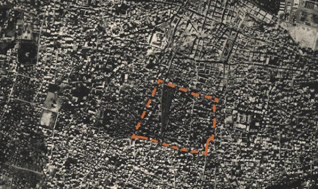
The historical architectural fabric of Roum is relatively intact and there are few construction sites active in the area. Due to the absence of public spaces in the neighborhood historically, its urban fabric is  characterised by an abundance of shared spaces between buildings, with public space redefined as the alleyways, lanes, and public staircases where residents meet and talk. 

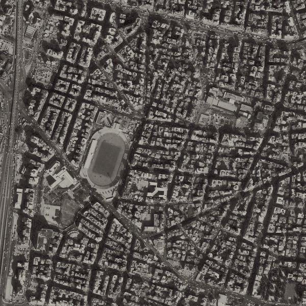
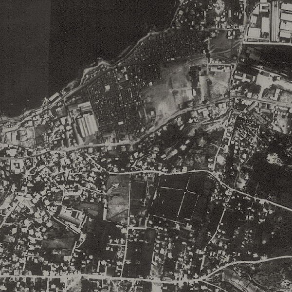
Whereas, Badawi is one of the districts bordering the Beirut River where Armenian refugees settled. During the French Mandate it was within reach of several sources of employment, including the military barracks, the railroad, and the port, as well as being close to Central Beirut. The district is made up of three neighbourhoods (hayy)—Camp Hajeen, Khalil Badawi Street, and Camp El Abiad—each of which has its own unique history of development and how it reached the status of a residential neighbourhood. 

In the past few years, before the ground floor premises of buildings along Mar Mkhayel Street were converted into cafés and restaurants, the price of a square metre of land in the neighbourhood, as well as rents, were low in comparison to other areas of Achrafieh, which was a factor in attracting new residents. Badawi was seen as a marginal neighbourhood in the Beirut suburbs that nevertheless enjoyed all the administrative benefits of the city centre, such as being connected to the city’s electrical grid and schedule. 

The economic and social transformation which began in Mar Mkhayel in 2008, had a direct impact on the residential make-up of Badawi, with many properties around Khalil Badawi Street sold to property investors. The entry of these small-time investors onto the scene contributed to a rise in the cost of accommodation and began to attract temporary residents, such as tourists and the wealthy, to an area that had historically been home to those on limited incomes who were unable to afford the costs of living elsewhere in Beirut. As the demand for affordable housing grew more acute, the conversion of apartments into individually-rented studio flats and rooms became common practice, which often resulted in unfit living conditions given the absence of proper housing regulations and policies for adequate housing.

Download the pamphlet:


Anyone who wants to see a living representation of the stages through which Beirut has passed, should head to Bachoura. Of all the city’s neighbourhoods, it is the closest to a picture of historical Beirut, and its mixed architectural heritage is a record of the city’s formation. There are old houses owned by wealthy families, and ancient courts with narrow alleys branching off from the main streets. Bachoura is a neighbourhood that throngs with life, its history having allowed for the development of unique social relationships. Children play safely up and down its cramped alleys, and old men sit together out on the pavement, talking and passing the time.

Commerce in Bachoura remains vibrant, as witnessed by numerous small shops and outlets for professional tradesmen, including carpenters’ workshops, antiques shops, car mechanics, small printshops, and stamp factories on the fringes of Bachoura Cemetery. Markets in the neighbourhood include the Carpenters’ Souk, the Metalworkers’ Souk, the Antiques Souk, and the Glass Souk. 

However because of its unique location, Bachoura has become the focus of real-estate speculation, the pressure of which is most evident in the radical architectural changes that have taken place over the years. The expansion of companies such as Beirut Digital District is one example of the processes  that threaten the neighbourhood’s diverse social and architectural fabric. 

Download pamphlet:


Ras Beirut does not refer to a single district, but rather a broad geographical area incorporating the districts of Hamra, Ain El Mreisseh, Raouché, and Verdun. Each of these districts (manaatiq) is divided further into a number of neighbourhoods (ahyaa). This pamphlet focuses on Hamra, providing data on property ownership and housing in the neighbourhoods within the area demarcated by Hamra and Bliss streets, which run east-west, and the north-south thoroughfares of Abdel Aziz Street and Sadat Street. 

Ras Beirut is known for its social and cultural diversity, though increasingly rapid changes to the city’s fabric have placed this reputation under threat. Property prices in the area are some of the most expensive in Beirut, and its proximity to the sea means that apartments here are sold for exorbitant amounts, beyond the reach of all but the wealthiest 7% of the population. 

The vast majority of new construction in Ras Beirut and Ain El Mreisseh is built over the rubble of older residential blocks and houses whose inhabitants have either moved out or been evicted, before being demolished. That said, some 57% of residential buildings in Ras Beirut are over forty years old (i.e. were built prior to 1975), with the greatest concentration of these older buildings in Hamra and Ain El Mreisseh. It is worth noting that property development in the area is not confined to the construction of modern buildings, but includes the conversion of older buildings into new investment opportunities, such as luxury commercial premises, hotels, and furnished apartments which are targeted at a highly specific market—including foreigners and wealthy students—and pose a threat to sustainable housing in the neighbourhood. 

In addition to the above, Ras Beirut has seen the emergence of another practice designed to exploit the demand for housing. Apartments are subdivided into rooms and rented out to a number of different individuals with the aim of increasing profit with little regard for living standards.

Download pamphlet:


The neighbourhood of Mousseitbeh has been through several waves of eviction and demolition in the recent past. The first of these was in 1972, when the state decided to lay Salim Salam Road and other road networks, and compensation was paid to evicted families in the area where the road was due to run. In 1982 the road was widened and a tunnel was dug, which had a further negative impact on the neighbourhood:
many houses were demolished and Mazra’a was cut off from Mousseitbeh. Residents attempted, with little success, to establish crossings over the road to reconnect the two sides.

When the civil war came to an end, many of the old-rent-paying tenants were asked to leave their homes in exchange for compensation. At that time, these payments were a considerable sum, sufficient to buy an apartment outside Beirut without need for a bank loan. It is said that Muslim residents went to Aramoun and Chhim in the Iklim area, while the Christians moved to Ain El Remmaneh, Mansourieh, and Ain Saadeh. 

Today, some of Mousseitbeh’s old quarters are threatened with evictions and total demolition, such as the Ablaa, Sofoh, Basha, and Furn alleys. These alleys are very old residential clusters, which for different reasons have managed to escape demolition, but their old-rent-paying tenants are being subjected to many pressures and face the threat of eviction. 

Download pamphlet: